
Report a mill: If county residents see anything unusual along their creeks, such as piled or stacked rocks, especially at shoals or tumbling water, call Tom Gresham at 706-742-7195.

Other than one wild goose chase in a 100-acre beaver swamp, Greg Yoder said he and Tom Gresham have had “darn good success for a couple of retired guys.”
Yoder and Gresham have spent the last three years exploring Oglethorpe County to find and document water mills as part of Historic Oglethorpe County’s Atlas Project. Project members Yoder, Gresham, Ashley Simpson and Elaine Neal pay for their research out-of-pocket.
“When Tom and I work on this, we have kind of a friendly competition,” Yoder said. “He'll find a mill, and I’m supposed to figure out whose it was, or I’ll find a sighting of a mill and see if he can go find it.”
They shared their work for the first time at Historic Oglethorpe County’s meeting last month.
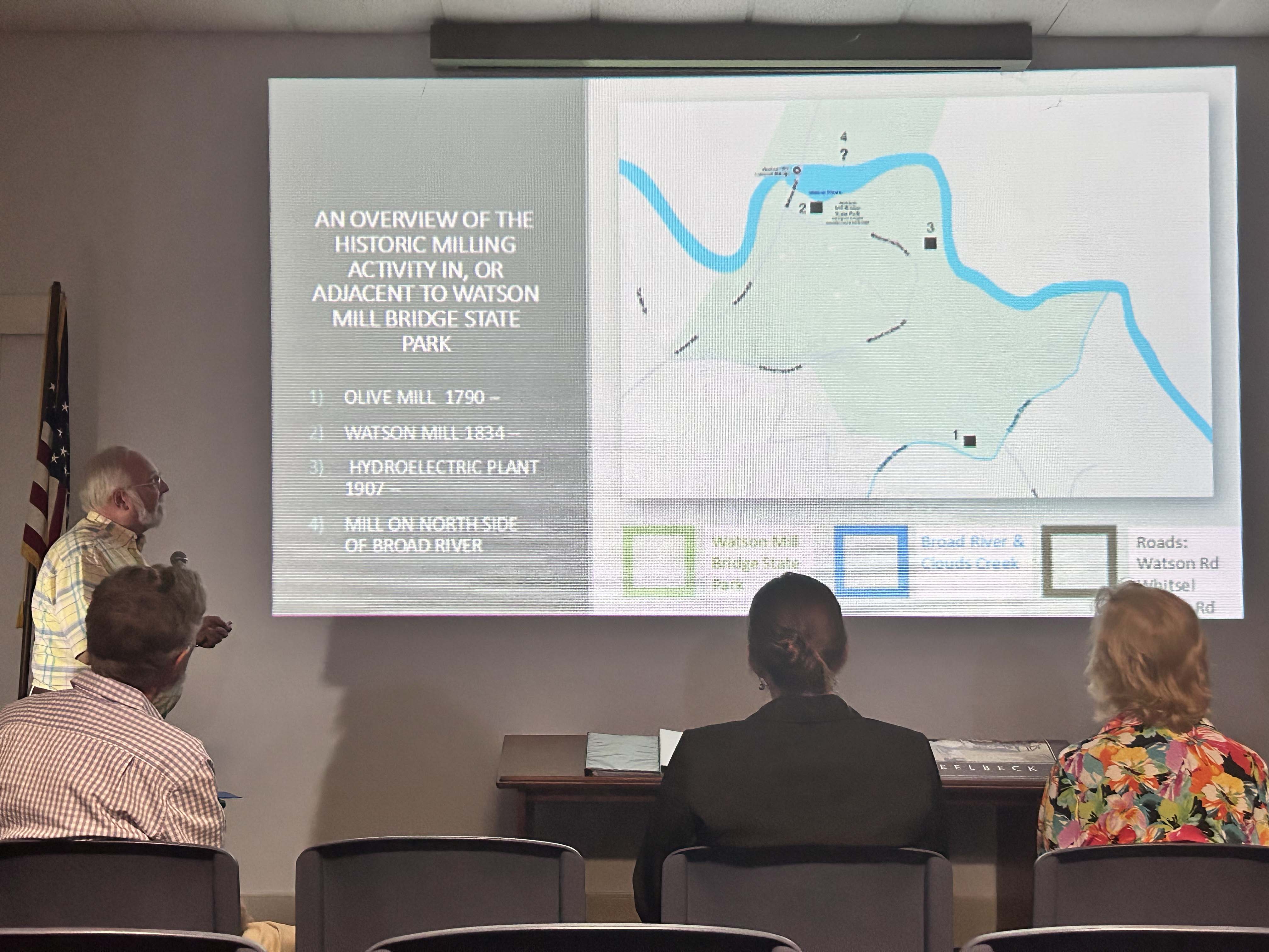
“Greg and I have been tag teaming again the exploration of mills,” Gresham said. “He is focused on documentary, research, deeds, maps, locating mills, and I’ve been doing most of the field work to try to verify location. And through this process, over the last three years, we’ve come up with about 42 water-powered mills in Oglethorpe County.”
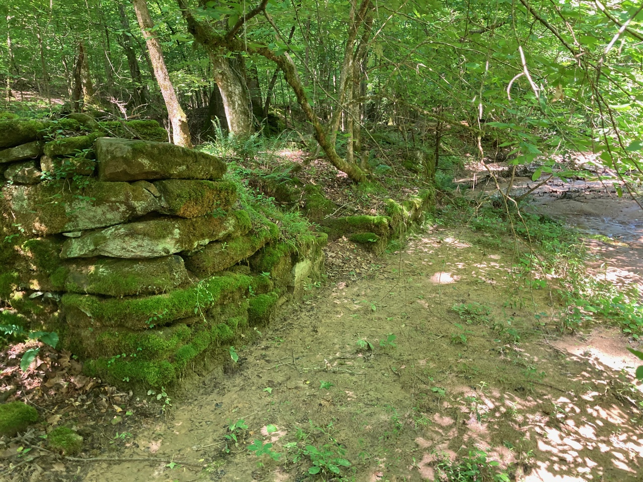
Several of the mills are well known, but others are on private property and obscure.
“So often, what we’re seeing with a mill dam is just remnants of the dam on either side of the flowing creek in the middle,” Gresham said. “Many of them have an earthen raceway, a head race that leads from the dam, the raised level, to the mill itself.”
A head race is a channel or ditch that carries the water downstream to power the mill.
Gresham said most of the mills are grist mills, which means they ground corn and flour, and sawmills. Later mills were able to cart wool and gin cotton.
One of the most well-known and important mills in the county was located where Watson Mill Bridge State Park is today.
“It was an area that afforded fording and ferrying, and subsequently a bridge from Oglethorpe County into Wilkes and Elbert and Madison County,” Yoder said. “And it also provided a perfect area in those shoal areas for a big, wide, high-flow river for all kinds of milling activity.”
Gabriel Watson bought the land there in 1871 and built a three-story mill and house. Neither of the structures are still there, and Gresham said they are unsure exactly where the house stood.
Yoder said the mill could have potentially been a sawmill, gristmill, flour mill, wool-carting mill, and maybe even furniture.
In 1905, Frank Edwards built a hydroelectric facility at the site of the old mill. He ran a wire 12 miles to power the Crawford Cotton Mills, later called Jefferson Mills, in Crawford.
“So think of a water-powered mill like your cordless power tools,” Yoder said. “Once you’ve got that power, you can almost do anything with it, if your engineers know how to gear it right.”
Gresham and Yoder look forward to continuing their work with the Atlas Project to document historic schools and churches around the county. The final product will be a digital location map with information on each mill.
It will also include a paper booklet with more information on milling and each individual mill.
“We just have a whole range of mills, from the smallest, earliest, little ones, a tub mill — to great, big commercial enterprises,” Gresham said. “We can really trace the commerce and the industry of the county through these mills.”