
Digital Atlas Project creating collection of county’s historic sites
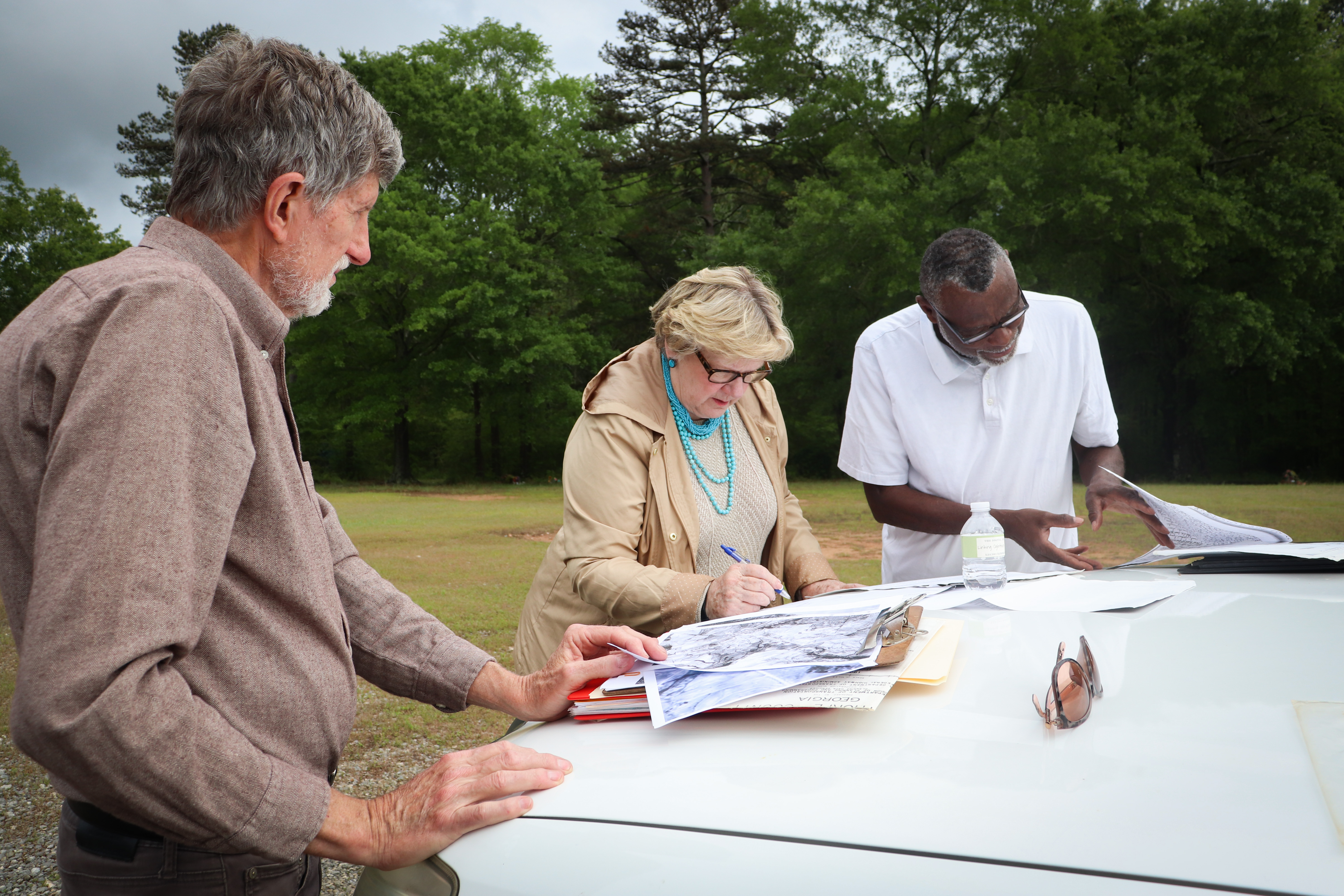
Between bouts of rain on a recent Friday afternoon, the sun was out just long enough for Ashley Simpson, Tom Gresham and Joe Baughns to meet outside St. John AME Church in Crawford.
They gathered around Gresham’s truck, where black-and-white pictures, hand-written deeds and aerial photographs were spread across the hood.
This research session may have been a strange sight to anyone driving by, but it was just another day of work for the Digital Atlas of Historic Oglethorpe County, a volunteer-led project assembling a digital map of the county’s historic sites.
Friday’s agenda included visiting two proposed former locations of Springfield Church, a Black Baptist church in Crawford.
Simpson and Gresham are half of the Digital Atlas team. Baughns is helping them locate the church, as he remembers when the second building was still standing.
The team believes that in 1894, the church may have been on land now owned by Richard Dickens.
“I’m thinking maybe that was a cemetery in there, and there was a church right in here,” Dickens suggested, pointing out a clearing in his backyard. “I would love to know.”
Gresham confirmed his suspicions, pulling out pictures of the old Springfield church sites.
“You guys are going back a lot of years,” Dickens said. “Somebody’s gotta get that down!”
“That’s exactly what we thought,” Gresham agreed.
Meet the team
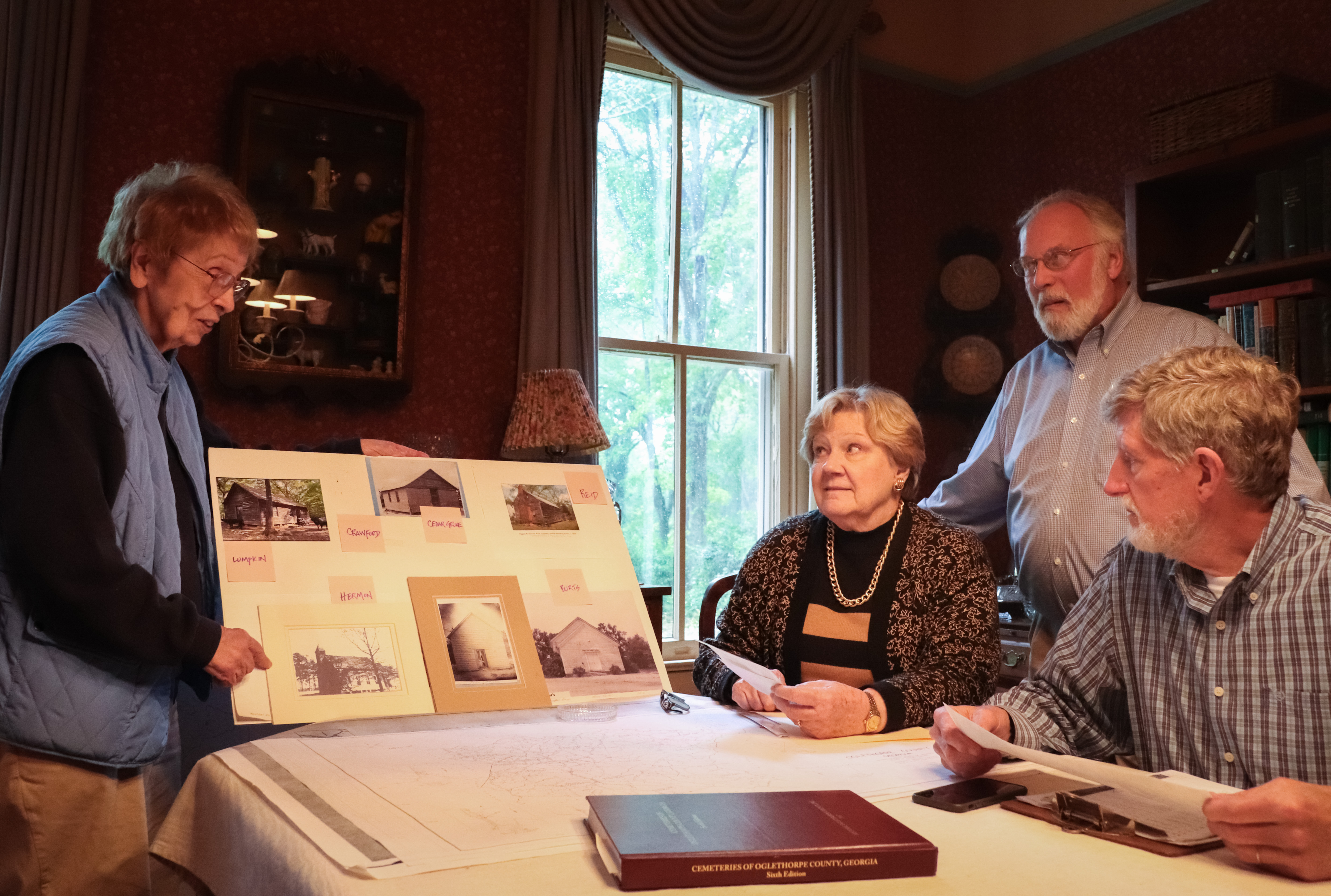
Gresham and Simpson work with Greg Yoder and Elaine Collier Neal to make up the Digital Atlas Project team.
These four local historians have been using their areas of expertise to map what used to be here, from rural one-room schoolhouses to hidden cemeteries reclaimed by nature.
Yoder is the bibliography expert, keeping track of deeds, land records and other public sources.
Simpson researches historic schools and churches; Oglethorpe County has been home to hundreds over the centuries.
Neal specializes in cartography, genealogy and government information, which she uses to map historic post offices.
Gresham, an archeologist and longtime resident of Oglethorpe County, has been mapping cemeteries since the 1990s.
Since 2020, they’ve been working toward a searchable, online database of every historic place they’ve found, with the hopes of educating Oglethorpe County residents about the history all around them.
Working from the ground up
Gresham’s book, “Cemeteries of Oglethorpe County, Georgia,” identifies more than 460 cemeteries throughout the county. It’s available for purchase at The Oglethorpe Echo and the Rowdy Rooster in Lexington.
While verifying their locations over the past few decades, Gresham would often come across other historic places — or what was left of them.
“He doesn’t see the rubble. I see some stones left from the dam, he sees the whole mill complex,” Yoder said.
Gresham had always wanted to put together some kind of atlas of Oglethorpe County, mapping not only cemeteries, but mills, bridges, churches, schools and anything else he found.
After he retired from operating his own archeological firm, he began to shape plans for the project. Neal, Yoder and Simpson quickly volunteered. The team is in its third year of research.
Bringing past into present
Fueled by their shared love for history, the team operates on their own time with their own resources.
While the project is still in the research stage, the ultimate goal is a digital map displaying the meticulously collected information.
Once accessible to the public, residents of Oglethorpe County, or those tracing their lineage to the area, will be able to research the historic sites their ancestors used.
“We find that people always want to know, ‘Where did mama live? Where did grandma go to school?’ ” Yoder said. “And generally nothing is in isolation. There was a church and then a cemetery, and then they had a school.”
Curiosity is human nature, and it’s common for people to wonder what was on their land, what their city was like 200 years ago, or even what structures existed in the past that have been lost to time.
The Digital Atlas seeks to fill the void left by a lack of easily accessible information on Oglethorpe County’s past: a whole new way for people to connect with history.
Community contributions
While the final database is still a work in progress, the Digital Atlas Project is already strengthening the connection Oglethorpe County residents have with their land.
When a tract of land on Wolfskin Road was recently sold, the county Planning and Zoning Commission informed the buyers of a mill site and cemetery on the property that the Digital Atlas team had located.
“We got a call from the new owner,” Gresham said. “He was very glad to know about it, and we were thrilled because that’s a big part of this. So many owners are certainly willing to protect it if they know about it.”
Oglethorpe County is the 43rd largest of Georgia’s 159 counties with 439 square miles, according to the U.S. Census Bureau. The sheer size of the county makes it difficult to pinpoint the exact locations of some structures that have been lost to time.
“You don’t just take off across the cow pasture. That doesn’t work,” Yoder said. “Especially when you have a county the size of Oglethorpe County. There are single contiguous forests the size of some small counties.”
Painstaking work is done to narrow the location of a point of interest, sometimes using items like aerial maps from 1942 or maps from the 1890s.
“We’re focused on the ones where we find remnants. Of course, some of them have been totally obliterated.” Gresham said. “If you build a series of four big chicken houses, there’s no way you’re going to find holes or anything like that, but we’re still able to put a dot on a pretty close general location.”
One of the most effective ways around identifying the hard-to-pinpoint locations is through community outreach.
While trying to locate buildings that had been torn down and paved over, Simpson spoke with an Oglethorpe County resident who had attended both the church and school in its older form.
“I had an interview with one of the people who grew up in this church and went to school here, and she was able to take me out in the parking lot and show me where those buildings (in old photos) were,” Simpson said.
“She told me about how the road had changed and various other things, so we have a good location for that, even though it has been bulldozed. There’s no way without that interview I would have any idea where those buildings were.”